BACK ON TRACK - MADANG, PNG
After Biak, the flight plans are ready to continue to Madang, PNG, our scheduled overnight before flying into the valley of Mount Hagen. With Mount Hagen's location, at rouhgly 6,000 feet, low clouds fill the valley surrounded by mountainous terrain.
In flight towards Madang, I texted G with the Sat Phone for an updated weather report since Madang and Mount Hagen do not report METAR and TAF.
As our flight proceeded towards our destination, the weather was not as expected. Build ups were beginning to appear on our radars and deviation for weather began along our route.
I'm in the first flight, our radar showing a red line between us and the airport, yet the airport is reporting VFR conditions.
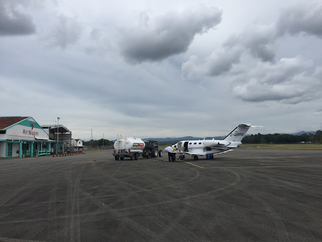
We began our descent by pilot discretion to 8,000 feet and notice a large break in the clouds - we aim for it. We level off at 8,000 feet and chose to fly over the water which we believed to be the best routing around the weather...ta da! We are VFR for the field but not before receiving a good wash of the plane along the way and some mild bumps. We continue with a visual landing and touch down in Papua New Guinea (PNG).
Last time I set foot in PNG was 30 years ago.


In flight towards Madang, I texted G with the Sat Phone for an updated weather report since Madang and Mount Hagen do not report METAR and TAF.
As our flight proceeded towards our destination, the weather was not as expected. Build ups were beginning to appear on our radars and deviation for weather began along our route.
I'm in the first flight, our radar showing a red line between us and the airport, yet the airport is reporting VFR conditions.
We began our descent by pilot discretion to 8,000 feet and notice a large break in the clouds - we aim for it. We level off at 8,000 feet and chose to fly over the water which we believed to be the best routing around the weather...ta da! We are VFR for the field but not before receiving a good wash of the plane along the way and some mild bumps. We continue with a visual landing and touch down in Papua New Guinea (PNG).
Last time I set foot in PNG was 30 years ago.


tower - a man standing in the middle of the airfield with a radio

We drew a crowd!


Comments
Post a Comment